WP 5 Downscaling of satellite based air quality products to urban scale
WP 5 leader: Prof. Dr. D. Atanassov
Results from WP 5
Downscaling of satellite based air quality products to urban scale
- Downscaling algorithms and scripts have been created for transfering BgCFWS (9km) results to local AQ model system in Plovidv for 24 meteorological parameters and 8 chemical species (Figure 1).
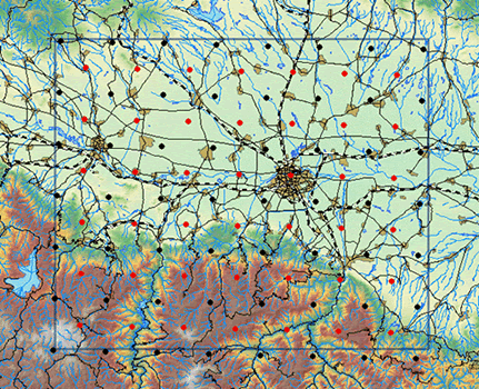
Fig. 1. Model domain Plovdiv and some of the "geographical objects":
wind data from BgCWFS; pollution data from BgCWFS
- Geospatial information from different sources (emissions, population etc.) for Plovdiv region have been transformed into GIS shapes and imported in ArcGIS.
- Bottom-up emission inventory for the region of Plovdiv has been made based on 450 questionnaries for household heating and traffic data from 22 street segments. Еxamples of the ways the residential heating and road traffic emissions have been calculated are presented in Figure 2 and Figure 3.
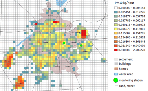
Fig. 2. Emission of PM10 released per 1 hour from the residential heating in the city of Plovdiv
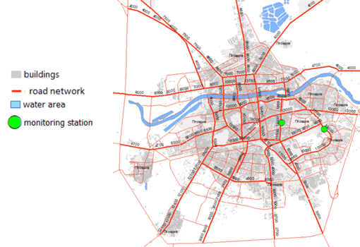
Fig. 3. Traffic flow on the main roads of the city – number of vehicles per day
|
|