ESSENCE, ROLE AND SIGNIFICANCE OF THE SYSTEM OF MONOGRAPHS ON ENGINEERING GEODESY
APPLIED GEODESY - PART 1. ENGINEERING GEODESY - Summary
The project "APPLIED GEODESY" of the authors G. Milev and I. Milev consists of three parts:
- Engineering surveying
- Application of Geodesy in Earth Sciences
- Non-engineering and natural scientific aspects of application of Geodesy
The three parts together treat the versatile application of Geodesy.
Part 1. ENGINEERING SURVEYING consists of three books:
- Basics, systems and technologies in Engineering Surveying – 498 p.
- Design and implementation of physical and general plans – 325 p.
- Construction of linear objects, buildings, facilities, installation of technological equipment. Plans of the built complex objects – due to the large volume, over 1500 pages, it is separated into three books - 3(3.1 – 524 p.), 3(3.2 – 530 p.) и 3(3.3 – 468 p.)
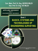
 Basics, systems and technologies in
Engineering Surveying - Book 1
Book 1 treats the fundamentals of Engineering Surveying – the modern: investment process, normative base, geodetic basis (digital data, plans, maps and control networks), instruments, apparatuses and systems; reference and coordinate systems and surfaces, theoretical bases of geodetic measurement processing, algorithms and software, modern numerical geospatial technologies and their application in Engineering Surveying and related information systems. The main issues of tracing are presented: essence, elements, methods, technologies, accuracy, norms and cases; theoretical bases and practice in the control and determination of displacements and investigation of deformations of engineering objects, including in landslides.
In fact the exposition in this part of the book refers to the theoretical and principal essentials, including systems, methods and technologies. Their specific application is further considered in the design and application of a complex of objects in Book 2 and in the construction of the individual particular objects in Book 3.
The presentation has an original structure. It corresponds to the current normative regulations and the possibilities afforded by the modern digital devices, instruments, systems and technologies. The book reflects to a large extent the views, long-term research, teaching experience and participation in the construction and investigation of engineering objects, including with original spatial constructive solutions of the authors.
The book can be used by lecturers, students and practitioners in the field of Engineering Surveying and all those who work on the construction and exploitation of engineering objects and their complexes such as architects, civil engineers – constructors, and specialists in the transport and water sector, etc., designers, contractors performing organization and control of construction and installation of technological equipment. Undoubtedly, it is recommended to do this, if necessary, at the same time with the other two books of the authors.
In digital form, parts of the first three books (including in English) are available in the electronic bookstore biblio.bg (password Георги Милев or tinyurl.com/2p9jyydn).
Such information, and for the last two books 3.2 and 3.3, will be uploaded there soon.